- Navigation:
- Back to the Corpus index page
- RSS
Dupplin Parish Church
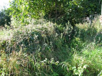
Dupplin Church, north wall, from north
- Dedication: unknown/St Serf
- Diocese of Dunblane
- County of Perthshire
- Perth and Kinross Council
- NO 0642 1943
Summary description
The slight remains of the medieval church are to be seen in a heavily overgrown graveyard on the north bank of the River Earn, on the southern edge of the Dupplin Castle estate.
Historical outline
Dedication: unknown/St Serf(1)
The early history of the church of Dupplin is wholly unknown. The earliest surviving reference to the parish occurs in Bagimond’s Roll in 1274-5, where it is listed as a free parsonage.(2) It was still a free parsonage at the time of the Reformation.(3) Towards the end of the twelfth or beginning of the early thirteenth century, the lands of Dupplin formed part of an extensive lordship in lower Strathearn held by the Olifard or Oliphant family and the church appears to have been in their gift as part of that lordship.(4) The advowson of the church of Dupplin was amongst the rights confirmed by King David II to Walter Oliphant and his wife, the king’s sister Elizabeth, when he erected the lands of Aberdalgie and Dupplin into a free barony in February 1365.(5) Rectors of Dupplin are named in 1471 (Mr Gilbert Anderson), 1493-4 (Sir John Myrtoun, who was also prebendary of Fargandenny) and 1510 (Mr Robert Hamilton).(6) The patronage of the church remained with their successors, the Oliphants of Gask, into the sixteenth century.
Notes
1. Cockburn, Medieval Bishops of Dunblane, 9.
Architectural description
Walls and linear mounds within the churchyard at Dupplin that are assumed to be the relics of the medieval parish church survive in an extremely fragmentary condition, and are now largely obscured by vegetation for much of the year. What is thought to be the north wall of the church is rubble-built and seems to have been clay-bonded; it extends for a length of about 14.8 metres and rises to a height of 1.5 metres in places. The width of the church may have been about 6 metres.
The church presumably fell into decay soon after it was united with Aberdalgie in 1618, but the churchyard continued in use as a burial place both for the local population and for the earls of Kinnoull, who held the Dupplin Castle estate until its acquisition by Lord Forteviot in the early twentieth century. Apart from a monolithic medieval stone coffin within the churchyard to the north-east of the church, the oldest of the visible monuments date from the 1720s.
Bibliography
Cockburn, J.H., 1959, The Mediaeval Bishops of Dunblane and their Church, Edinburgh, 9.
Cowan, I.B., 1967, The parishes of medieval Scotland, (Scottish Record Society), Edinburgh, 55.
Donaldson, G., 1949, Accounts of the collectors of thirds of benefices, (Scottish History Society), Edinburgh, 16.
Dunlop, A.I., 1939, ‘Bagimond’s Roll, statement of the tenths of the kingdom of Scotland’ Miscellany of the Scottish History Society, vi, 1-77, at 54.
New Statistical Account of Scotland, 1845, Edinburgh and London, x, 880.
Regesta Regum Scottorum, Acts of William I (1165-1214), 1971, Edinburgh, no 484.
Regesta Regum Scottorum, Acts of David II (1329-71), 1982, Edinburgh, no 341.
Registrum Magni Sigilli Regum Scotorum, 1882, ii (1424-1513), Edinburgh, nos 1231, 2178, 2569, 3544.
Royal Commission on the Ancient and Historical Monuments of Scotland, Canmore database.
Statistical Account of Scotland, 1791-9, ed. J. Sinclair, Edinburgh, xi (1794), 162.
Map
Images
Click on any thumbnail to open the image gallery and slideshow.


